this post was submitted on 04 Jul 2024
45 points (100.0% liked)
Top View
624 readers
2 users here now
A place to share pictures taken from above, that reveal interesting views, fascinating places or different angles to places.
I have made a short video describing how I take the pictures that I share, here
This is not a rule! You are welcome to share any aerial picture you feel is worth sharing. I just thought that maybe some of you may need a little help. It's really addictive once you get started!
TOP POST
(updated manually)

La Plata - Argentina
founded 1 month ago
MODERATORS

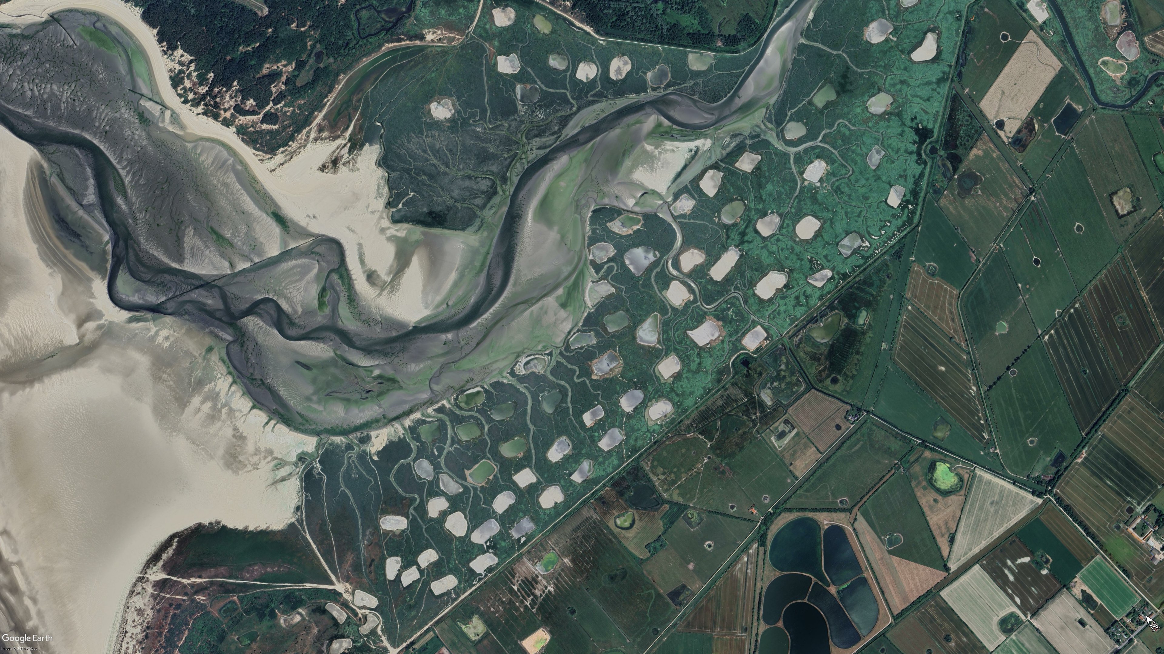
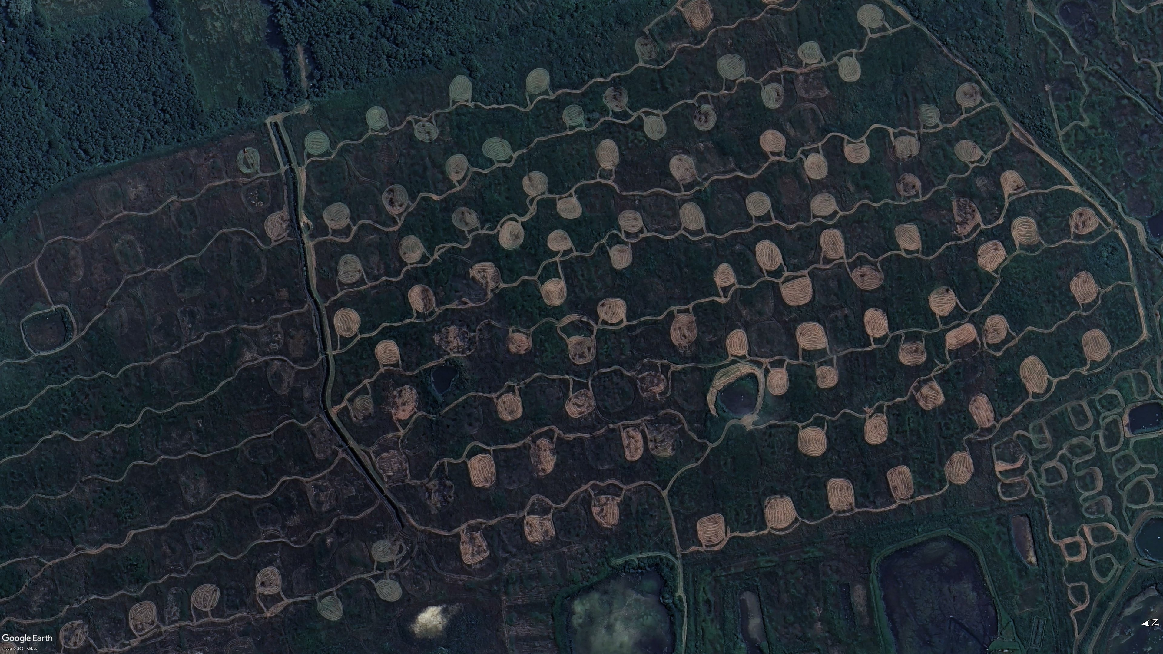
Unless I got the coordinates wrong, it appears to be part of a protected wetland area called Marais de Balençon. I can't find much more information aside from hiking trails and this very short description on the merlimont website.
I might be off by a bit though, navigating maps on a phone is a pain for me.
I think you're right about the area
This page (google translated) suggests they are either mown fields, duck hunting areas, or areas disrupted and monitored for the effect on bees
Interestingly, I think the second photo from the carousel on your link shows one of these areas
You might be right. I could not discern anything in those blurry pictures for the life of me.