Hey there,
it's been a while since my last post. Since then - with the help of this awesome community - I have added multiple new features and fixed a lot of bugs.
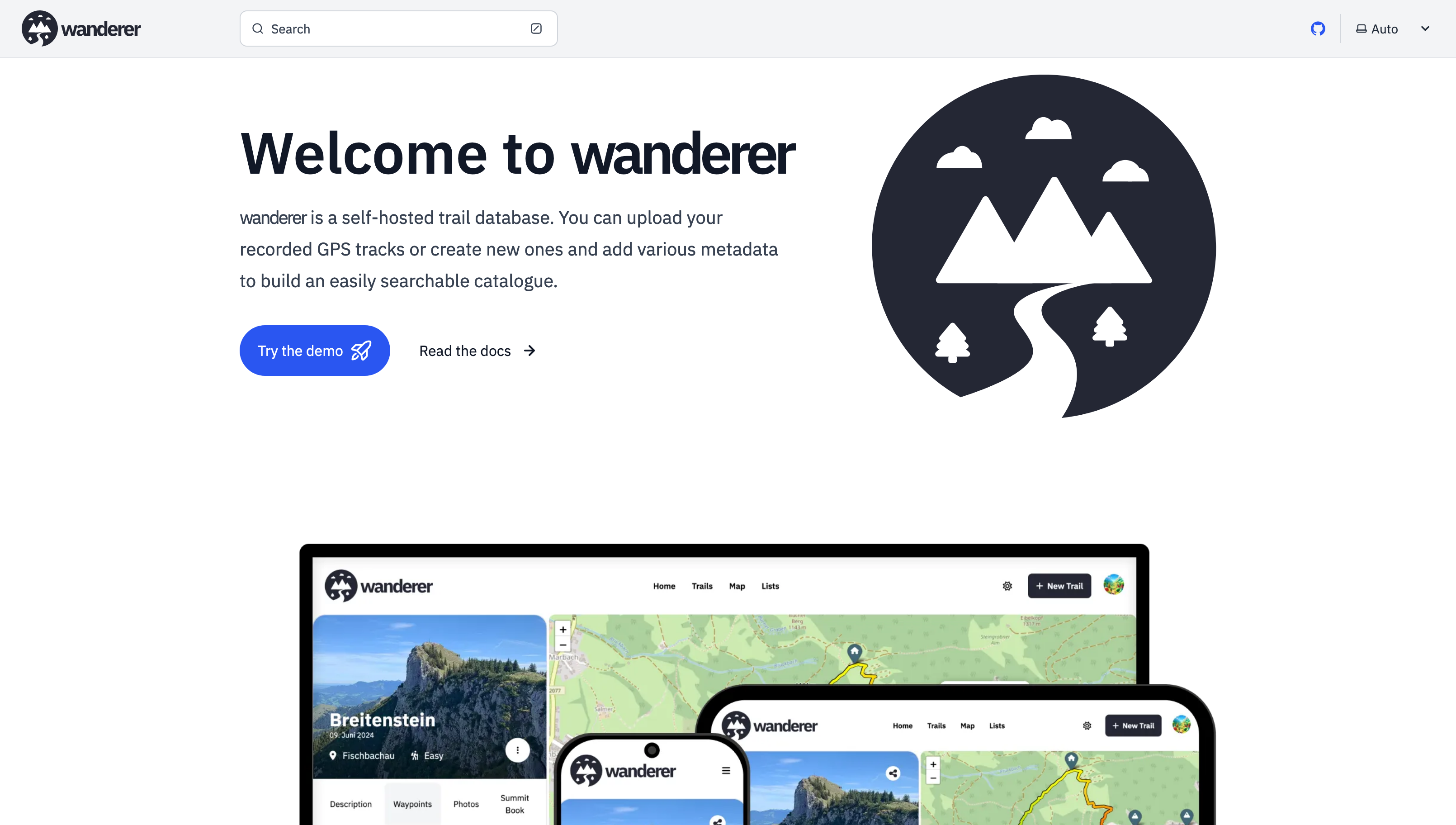
Most importantly there is now a working demo alongside a shiny new landing page.
And here are some more fun features I added since then:
- Trail drawing: in addition to uploading you GPX, TCX or KML files, you can now also simply draw a trail by defining multiple waypoints. The route between them will be calculated automatically.
- Sharing trails: simple and straightforward - you can share your trails with other users and let them view or edit.
- Printing trails: there is now a dedicated print view. Plan your adventure digitally and then take it with you on paper.
- wanderer is now available in 8 different languages (thanks to translators from the community). If you would like to contribute a translation you can do so here.
- You can now bulk upload multiple trails at once simply by putting them in a dedicated auto-upload folder
And much more. I'd be happy if you give it a try in case you haven't yet.
GitHub repo: https://github.com/Flomp/wanderer
It looks amazing!
How well fitted would this be for a Google maps timeline replacement?
I see you mention we need to upload the files which maybe could be obtained from an app like https://github.com/mendhak/gpslogger
I already had a flow to have them on my server with syncthing, so I could easily use your api to process them.
The thing would be to have each trail be marked as each day and have a way of showing them nicely (I haven't tested everything in the demo hehe).
Is there a plan to be able to process any GPS standard to automatically generate the trails?
I'm currently using traccar, but it looks more like a fleet management than something to remember where you've been.
Have you seen owntracks? They have client apps too.
Just tried it and seems too complicated haha. With traccar I just had to deploy a single service and use either the official app or previously gpslogger sending the data to an endpoint.
With owntracks the main documentation seems to be deploy it into the base system, docker is kind of hidden.
And with docker you need to deploy at least 3 services: recorder, Mosquitto, and the front end.
The app doesn't tell you what's expected to be filled into the fields to connect to the backend. I tried with https but haven't been able to make it work.
To be fair, this has been just today. But as long as a service has a docker compose I've always been able to deploy it in less than 10 minutes, and the rest of the day is just customizing the service.