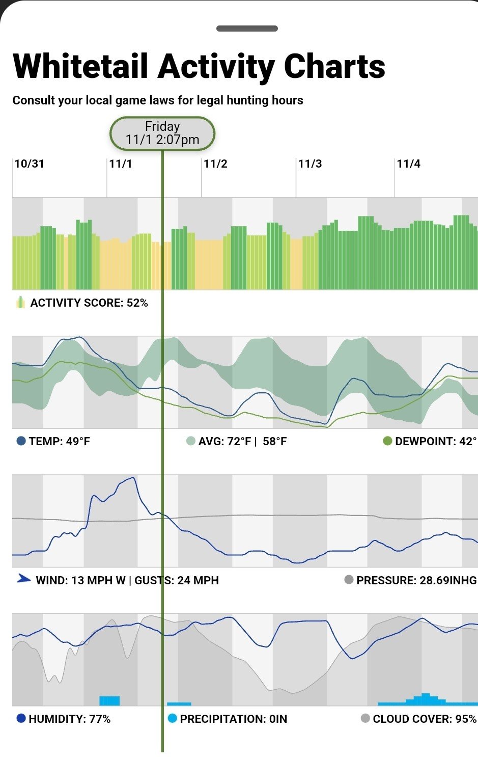
Maybe the shaded area is some sort of long run expected range of temperature, based on a sample of past years?
The top of the range has a nice daily insolation profile (cloud free), temp peak lags solar noon a bit. The lower green range are maybe repreenting cooler cloudy days, so less regular.
So around and after the green vertical line it will be unusually cold until shortly after dawn on the third when it will be back in the expected range for a day or so. Temp stays above dewpoint, so no ground level mist (just)?
naah - just guessing - it tells me there is more information needed / bad graph.

