this post was submitted on 18 Oct 2023
154 points (100.0% liked)
traingang
22598 readers
28 users here now
Post as many train pictures as possible.
All about urbanism and transportation, including freight transportation.
Home of train gang
:arm-L::train-shining::arm-R:
Talk about supply chain issues here!
List of cool books and videos about urbanism, transit, and other cool things
Titles must be informative. Please do not title your post "lmao" or use the tired "_____ challenge" format.
Archive links for reactionary sites, including the BBC.
LANDLORDS COWER IN FEAR OF MAOTRAIN
"that train pic is too powerful lmao" - u/Cadende
founded 4 years ago
MODERATORS
you are viewing a single comment's thread
view the rest of the comments
view the rest of the comments

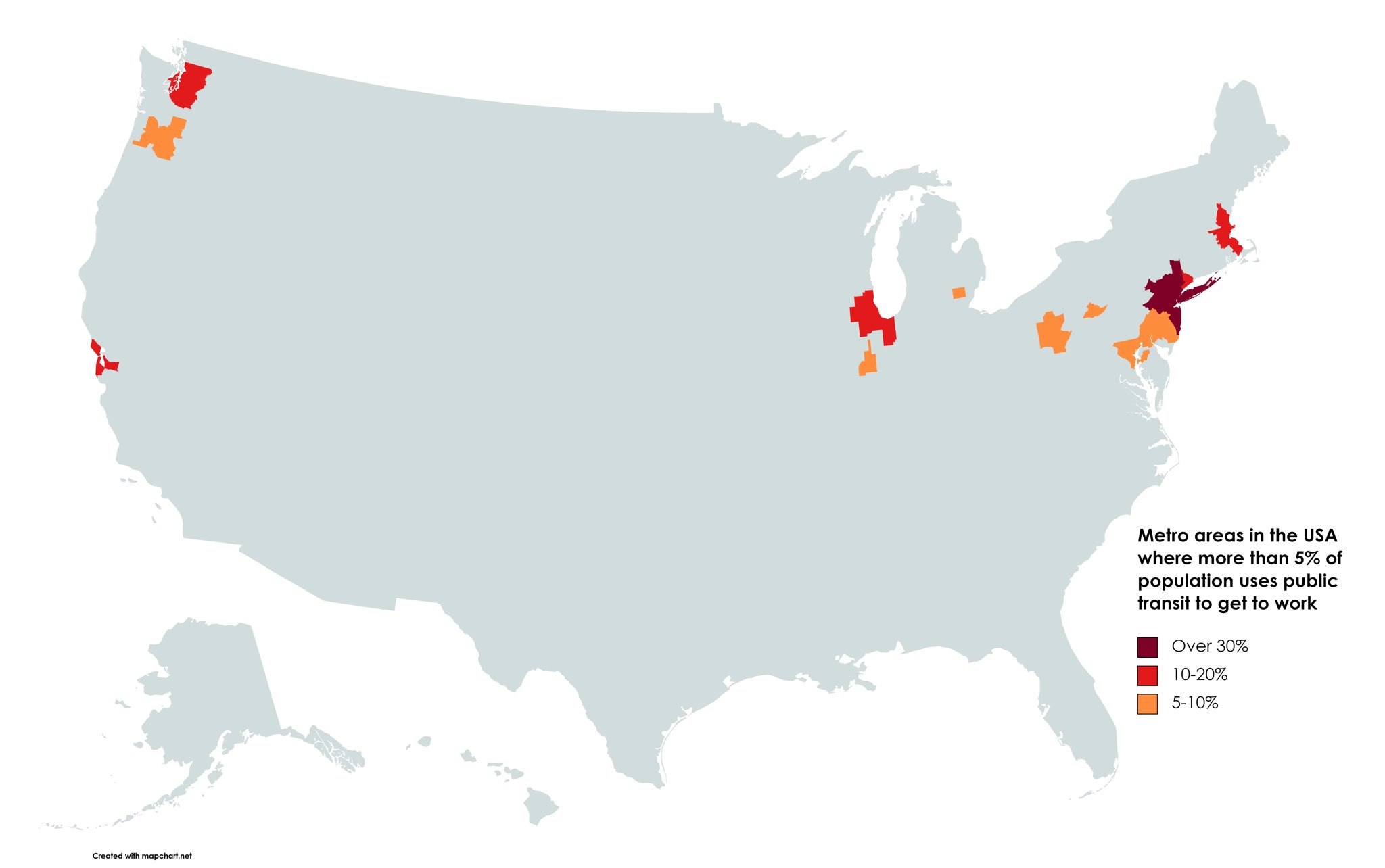
What are all the cities? I can point out some on a map easily, but not others.
I see Seattle, Portland, New York City, Boston, and Chicago for sure. Possibly Pittsburgh, Ann Arbor, San Francisco, Philadelphia, Washington DC, and maybe Springfield Illinois? A bunch of them are hard to tell without the state borders.
Here's an article with a little more detailed plot : LINK
A bunch of of them are college towns, the one in in Illinois is probably due to UIUC, also Penn State in the middle of PA.
Baltimore is also in the orange splotch.
the red part of connecticut is stamford i'm assuming, it's a city close to new york that's basically mini NYC. i lived there, good amount of people take the train